General Considerations

Car Parking and Transport
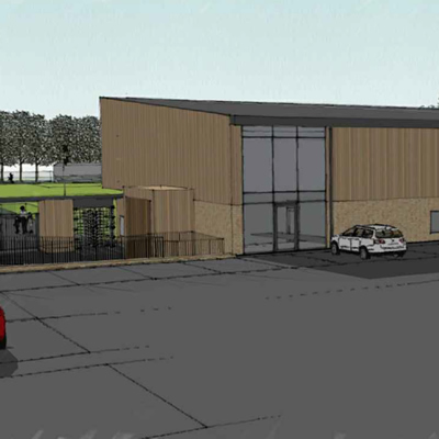
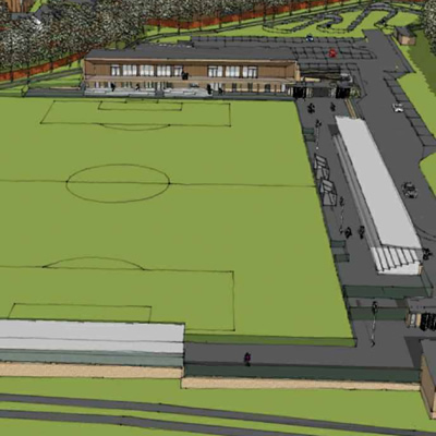
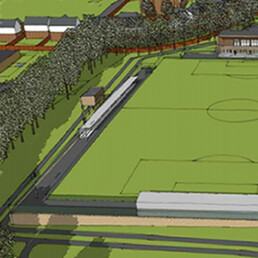
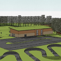
A car parking appraisal has been completed by the Highway Consultants to ensure that sufficient car parking will be provided. Using adopted car parking standards it has been established that a permanent car park on the Dunmow Road site of 69 (+5 disabled spaces) and Birchwood High School site offers 172 spaces is reasonable for a development of this size. The total spaces will allow general usage and any special sports events and for any overlapping arrivals/ departures. It is important that sufficient car parking and any mitigating measures are provided to ensure that local residential roads are not used for car parking at any time.
There is a bus stop located right outside the site on Dunmow Road which is well connected to the town centre. In addition, there are proposals for a significant new cycleway linking this part of the town to the rest of the town and beyond to Stansted Airport, which would provide major opportunities for bike use to and from the site.
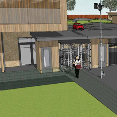
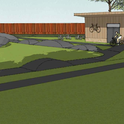
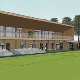
A pedestrian footpath and cycle entrance exists from Parsonage Lane into the site. This will give the school a close access point to use the facilities within the new pavilion during the daytime. The proposal is aimed at encouraging the use of public transport, cycling, and walking to site, with adequate provision for car and coach drop-off as required. 40 new cycle racks under shelters within the carpark are proposed as it is anticipated that there will be people attending the facilities via foot or bicycle given that the proposed location is close to the town centre.
Car Park Management:
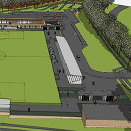
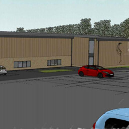
Entrance to the proposed new 74 space car park will be from Dunmow road via a two way tarmac access road. The car park itself will have automatic gates which will provide access during opening hours. Parking here will be free, but we will employ a car park management system such as Parking Eye to ensure that only people visiting the sports facilities and school will benefit from this provision.
Weekdays
The new car park will be available for 6th form parking from 8am – 4.30pm. This will help to alleviate the long running issue for local residents and businesses of students parking in the nearby residential roads and industrial estates. A maximum of 20 parking permits will be issued to 6th formers.
The new sports facilities will be available for community use from 10am during term time and 9am during school holiday periods. This time has been allocated to avoid the site creating additional morning rush hour traffic in the area.
Weekday Evenings
The new on-site carpark will remain open until 9pm with a small number of possible exceptions, when it will be closed at 10pm
Evening use of the new facilities is likely to be heavier and visitors who drive will have the option of parking either on the new site, or on the main school site. We already have a thriving community lettings programme running on the main school site with parking in zones A and B available for community parking. When the new sports facilities open these will be available 3.30pm – 10pm during term time and from 8am -10pm during school holiday periods and weekends. The new facilities are a short walk across the road via a pelican crossing from the main school site.
Weekends
We intend the new site to be open from 9am – 7pm on Saturdays and 9am – 6pm on Sunday
Arboricultural Impact Assessment
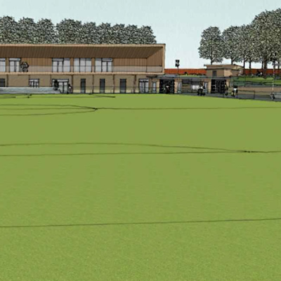
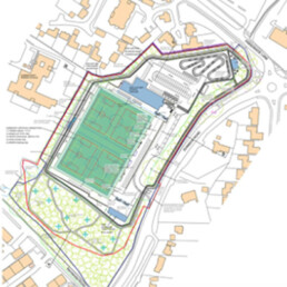
We have carried out an Arboricultural Impact Assessment, Tree Protection Survey and Tree Survey Table, which will be submitted as part of this application. The possibility of a new line of trees will be planted along the northern edge of the site to screen the residential properties in Birchwood Mews. A Landscaping consultant with work with the school and our nearest local neighbours to determine the best possible screening options for noise, light and security
Floodlighting
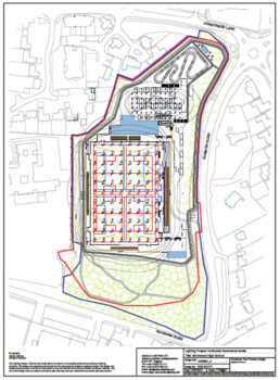
The proposed floodlighting design has been proposed by a specialist company to reduce its impact on the vicinity. The floodlights proposed will be directional with low vertical overspill, minimising light pollution to help mitigate any impact upon residents and wildlife. Lowering the overall level of the pitch also helps reduce the height of the floodlight columns. Light overspill will be further reduced by the introduction of additional trees along the boundary. In addition, there will be low level lighting proposed to both the pump track and carpark. Downward directional security lighting will be provided as required for the main building and paths.
Acoustic Plan
An Acoustic Assessment has taken place for the facility, including consideration for possible use by the Bishop’s Stortford Football Club. The aim being to assess the impacts of possible fixtures and mitigations to reduce the amount of noise from the facility.
The assessment concluded that “Noise will be audible at nearby dwellings but not significantly above existing ambient noise levels. At some locations closer to the site higher average and maximum noise levels are predicted to arise at first floor level. Here a balance of frequency and duration of impact and respite will be used to achieve an acceptable sound environment.
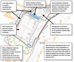
The locality is one where a level of noise from education establishments and community use is to be expected.
There will be an increase in the use of the site and this will result in a loss of respite for residents compared to the existing sound environment. Predicted noise levels are acceptable and are not expected to result in adverse impact at the majority of locations with limited effect at others. This requires balancing against the planning objectives and the wider needs of the school and community. Such a balance is a planning consideration and not one of noise impact in isolation.
Flood Assessment
A Flood Assessment has been undertaken and identifies areas falling within both Flood Zones 2 and 3a.
With a modelled flood level of 52.06 mAODN (1:100yr +20% CC). The Site levels vary between 49-54.1 mAODN, with a proposed FFL of the pavilion of 52.36 mAODN, 300mm above modelled flood levels. The pavilion building is only shown as encroaching into flood zone 2. The loss of 55m2 flood storage area is more than compensated for on a level for level basis by the reduction in levels in the car park area and sports pitch area. The proposed development will be registered to the Environment Agencies Flood Warning System. Attenuation will be provided to allow surface water discharge from the site to be reduced to 4.6 l/sec, designed for a 1 in 100 year event plus 20% climate change. Storm water will be discharged to the surface sewer as the only available form of disposing of storm water from the site, In lieu of the culverted watercourse being the source of flood risk to the local area and likely being at capacity in peak storm events. A class 1 Bypass petrol interceptor is included to serve the carpark area. Considering the above, we consider the proposals acceptable from a flooding and SUDs perspective.